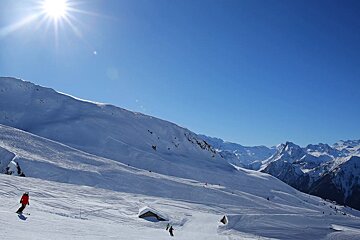
© La Plagne

Sunny intervals & light snowfall this week
Our 7-day forecast for the week of 19th February 2018
The weather looks set to remain fairly settled this week with a weak area of high pressure in place on Monday. This will be replaced by a ridge of low pressure on Tuesday when it will be a bit windier than of late due to a compression in the isobars. Winds will drop off overnight on Tuesday and remain nice and light for the rest of the week.
Very little precipitation is likely this week, with a slight dusting of snow likely on Tuesday when around 2cm might fall and then another 2cm on Thursday. Thanks to a fairly low freeze height of around 1100 metres, it should fall as snow at all but the very lowest of elevations.
It looks like it will be an unpredictable few days for the all-important Jetstream, which will start the week to the north of the region before sweeping down directly above us (albeit between the troposphere and stratosphere some 14km above the ground). It will remain fairly constant in its speed at around 100mph (160kmph).
Sunny intervals will be the main weather pattern this week, with the exception of Thursday which will be predominantly cloudy. The freeze height looks likely to remain between 900 metres and 1100 metres throughout the week, good news for the snow condition. A large area of high pressure currently sits between Portugal and the Azores and this should head our way, which should lead to a nice settled mid and end of the week, with hopefully continued prolonged sunny intervals as the week goes on.
Monday
After a sunny start, clouds will build as the day goes on. Winds will increase from around 7kmph in the morning to 12kmph in the afternoon. Coming from the north, they will make it feel a bit colder than the -4ºC that is likely as the daytime resort “high”.
Tuesday
On the whole a sunny day. Temperatures will top out at around -2ºC and winds will be a bit stronger at around 15kmph, with gusts of around 30kmph. Afternoon lift disruptions are possible, particularly at higher elevations. A light snowfall, little more than flurries, is possible in the afternoon when around 2cm of snow is likely to fall.
Wednesday
After a gloriously sunny start, clouds will build around lunchtime and the afternoon should consist of sunny intervals. Winds will decrease as the day goes on from around 15kmph in the morning to 8kmph in the afternoon and remain northerly in their direction. Another chilly day with daytime resort highs of around -5ºC.
Thursday
Sunny intervals to start the day, with clouds building from mid-morning. A very light dusting of snow is likely between 15:00 and 21:00. Temperatures will remain consistent with a daytime resort high of around -4ºC and very light north-northeasterly (NNE) winds.
Friday
A mainly sunny day (probably the sunniest day of the week, so grab a deck chair!) with very light winds from the west (5kmph). Temperatures will remain at around -4ºC in resort in the afternoon.
Saturday
A mainly lovely sunny day with light northerly winds at around 8kmph. Afternoon highs of around -3ºC in resort. Cloud will build as the day goes on and interrupt the sunshine in the afternoon.
Sunday
A similar day to Saturday with sunshine in the main. Light winds will veer to the west, at around 5kmph. Temperatures should get up to around 0ºC by mid-afternoon.
More inspiration...
Check out our day to day weather forecast for more information.