© © The North Face® Ultra-Trail du Mont-Blanc® - Pascal Tournaire

© Katy Oliver de Jonge

© Alison Shayler

© Alison Shayler

© Alison Shayler

© Alison Shayler


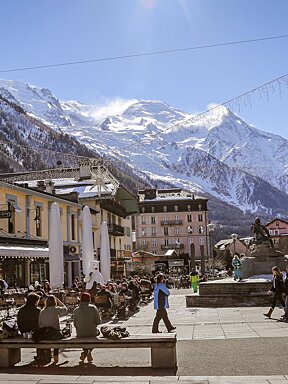
Chamonix 2013 UTMB Review
UTMB winners & high valley hiking
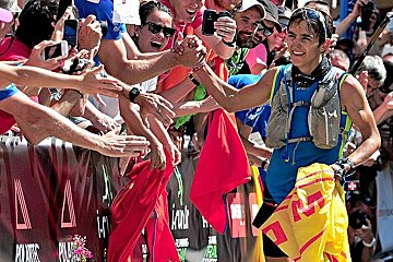
The breaking news is that Chamonix has become a zombie town... stiff-limbed creatures shuffling and staggering through the streets, many with a look of vacant exhaustion on their faces, some sporting an array of bruises and bandages. It's a far cry from last week when they were all limbering up in eager anticipation but since then they have covered an awful lot of very steep ground.
After the Noah's flood style weather of previous years the 2013 edition of the Ultra Trail du Mont Blanc broke entirely with tradition by taking place under perfect blue sunny skies. Past UTMBs have been marred by torrential rain, overflowing rivers, mudslides, hypothermic runners, people skidding in mud and crashing into cows in the pitch dark (OK, maybe that last one's not a common problem but it did happen to a friend of mine last year!).
However, this year the weather definitely seems to have had a positive effect on the morale of the event; all the runners I spoke to were on cloud nine and full of praise for the organisers, the volunteers, the spectators and, of course, the amazing route that spans three countries. A few expressed disappointment that so much of it takes place in the dark so that they couldn't see all of the scenery but I guess in a race that can take up to 46 hours then running through the night is kind of inevitable!
The winners of the 4 races were:
UTMB men : Xavier Thevenard 20:34:57
UTMB women : Rory Bosio 22:37:26
CCC men : Jordi Bes 11:23:01
CCC women : Caroline Chaverot 14:12:00
TDS men : Arnaud Julia Bonmati 15:09:59
TDS women : Nathalie Mauclair 17:36:41
PTL team : Ah Léon s'y r'met - James Linder & Patrick Monnet 135:48:06
All results and times can be found here, big congratulations to everyone who took part, I am in complete awe of you!
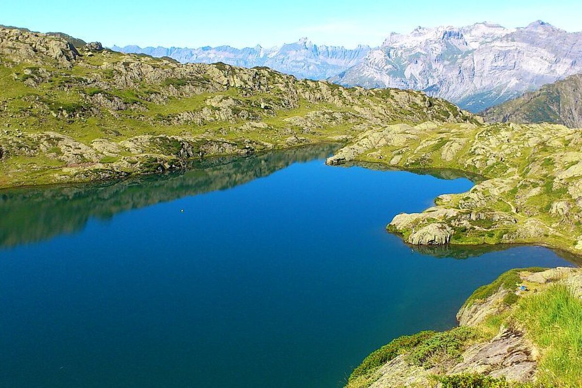
Bearing in mind that the lifts close soon (see dates here) I thought I'd make use of my season pass and head up for a hike around Brévent this week. I stopped on the way for sandwiches from the new organic épicerie on Rue des Moulins then took the lift up from town to Planpraz and then the cable car up to the summit. From here we headed down the rocky path and followed the signpost for Lac du Brévent. The route is downhill all the way and very rocky, but not particularly dangerous, poles are a good idea if you're prone to tripping over your own feet (like I am). The lake took about an hour to reach and was a beautiful spot for a picnic lunch; the water is a bright clear blue and surrounded by lots of secluded grassy patches and big flat rocks that make great sun loungers. The view across the valley to the Rochers des Fiz is incredible, great towering jagged rocks that look so prehistoric that you can practically see pterodactyls swooping over them, or maybe that's just me...
Anyway, we stayed long enough to refuel and rest our legs then we continued along the same path to the Refuge Bellachat, following the red and white marks painted on the rocks. Once there we had the option of winding our way back down to the valley but we wanted to get up high, onto the ridge. If you have the same plan then don't follow the signs to Les Houches/Merlet, seek out the other signpost that points you towards Aiguillette des Houches. The path is less obvious than the others, so don't miss it like we did, otherwise you'll have to scramble up a sketchy section of steep rock to rejoin it - not advisable (I hope my mum's not reading this).
Once you're on the ridge you'll understand why it's worth the effort; drop-away views on either side into neighbouring valleys, Mont Blanc looming above, the Les Bossons glacier looking so close you could touch it, rocky peaks and green rolling mountains stretching as far as the eye can see... it's also pretty weird when you can see birds and paragliders flying past beneath you! The trail is fairly flat with a few undulations until you reach the sign that gives the elevation of Aiguillette des Houches (2285m). From here you follow the steep winding path back down to Merlet going from mountain tops, through Alpine pastures, into forest, then eventually out by the Merlet Animal Park (follow signs for Merlet Parc, not Merlet parking). In between the park entrance and the first car park there is a path that leads back down to Chamonix, bringing you out at Les Gaillands, just a short walk (or an even shorter train/bus ride) back into town.
This walk took us around 5-6 hours with a couple of stops for lunch and rests, take plenty of water as there is nowhere to fill up along the trail and if you have poles then your knees will be glad of them on the downhill!